Quick answer: Choose a drone survey company that commits to an accuracy figure in writing, uses DGPS ground control, gives a checkpoint report, flies and processes the data with its own team, and handles airspace permissions. Compare quotes on the same deliverables. An error found later in a project costs far more than the survey itself.
The 10 questions
1. What accuracy will you commit to in writing?
A clear answer is a height accuracy such as ±5 cm. Be careful of answers like “high accuracy” or “centimetre level” with no number.
2. How many ground control points will you use, and how will they be measured?
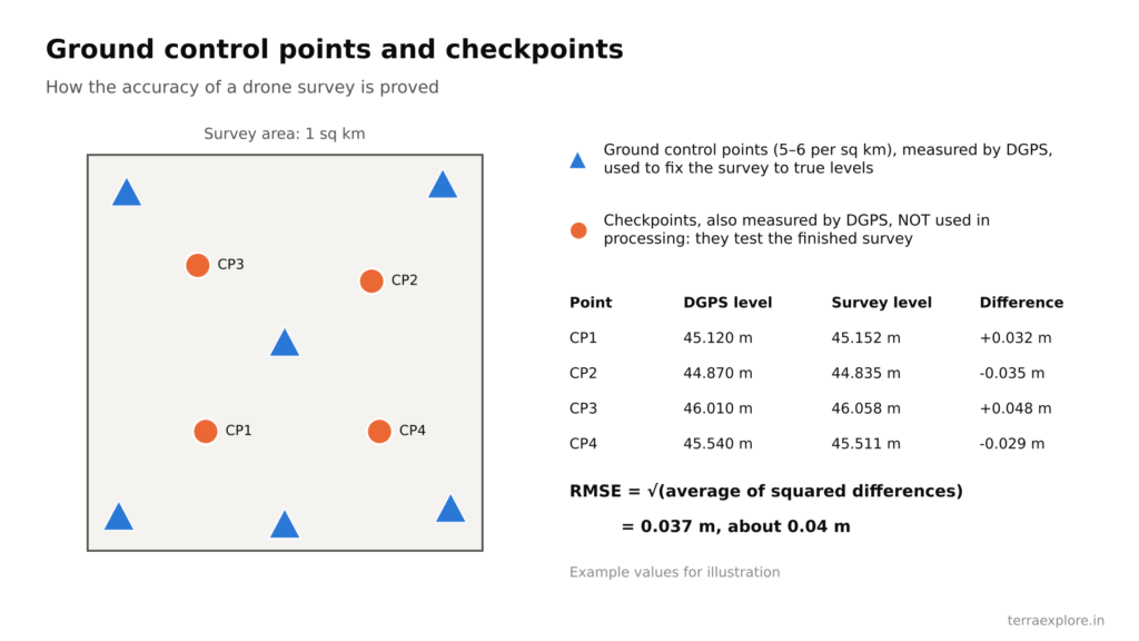
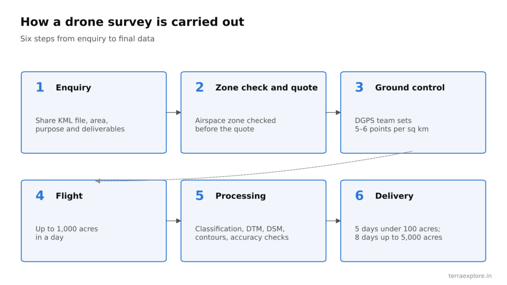
Control points should be measured with DGPS. For reference, TerraX uses 5–6 per square km.
3. Will you give a checkpoint report?
The report should compare the survey with checkpoints not used in processing, and give the error as RMSE. See Drone Survey Accuracy.
4. Do you fly and process the data with your own team?
Some companies fly the drone and send the data to a third party for processing. This adds delays and coordination errors and can lower accuracy. Ask to meet the processing team. Some companies say they do it in-house when they do not.
5. Are your pilots certified and your drones registered?
Pilots need a Remote Pilot Certificate, and each drone needs a UIN on DGCA’s Digital Sky platform. See Drone Survey Permission in India.
6. Will you check the airspace zone before quoting, and who gets the permission?
A good company checks the zone from your KML file before quoting, so there are no surprises later.
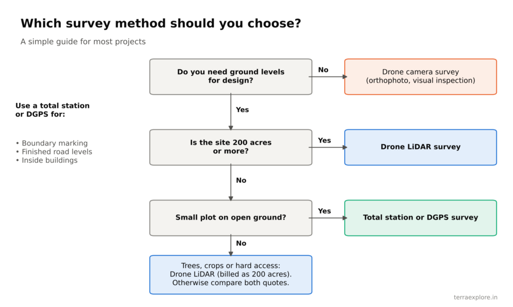
7. Camera or LiDAR: which do you recommend for my project, and why?
If you need ground levels on land with any vegetation, the answer should be LiDAR. If a company offers only one method, ask how it will handle vegetation.
8. What exactly is included, and what costs extra?
Get the list in writing: orthophoto, DTM, DSM, contours, CAD drawing, point cloud, feature mapping, travel and GST.
9. When will I get the final data?
Ask for a delivery time in days. TerraX delivers in 5 days for sites up to 1,000 acres and 8 days for sites up to 5,000 acres.
10. What if there are errors, and how long do you keep the data?
Ask whether corrections for errors on their side are free, and how long they keep your data.
Warning signs
- No accuracy figure, or no checkpoint report
- A price far below the market with no clear list of deliverables
- No sample data to show
- Processing done by an unnamed third party
- No questions about your purpose before quoting
How TerraX answers these questions
| Question | TerraX |
|---|---|
| Accuracy | ±5 cm in height; 0.04 m RMSE on a 247 sq km LiDAR project |
| Ground control | DGPS, 5–6 points per square km |
| Team | In-house certified pilots, processing staff and DGPS team |
| Permissions | Zone checked before every quote; green and yellow zones handled |
| Included | Orthophoto, DTM, DSM, contours, 3D model, CAD drawing; point cloud for LiDAR |
| Extra | Feature mapping, GST, travel outside Ahmedabad |
| Delivery | 5 days up to 1,000 acres; 8 days up to 5,000 acres |
| Corrections and data | Free corrections for errors on our side; data kept for 2 months |
| Payment | 20% advance, 50% on completion, 30% after submission |
| Sample data | Available on request |
Frequently asked questions
How do I choose a drone survey company in India?
Ask for an accuracy figure in writing, DGPS ground control, a checkpoint report, in-house flying and processing, airspace handling, and a written list of deliverables and timelines.
Is the cheapest drone survey quote the best value?
Not always. Compare quotes on the same accuracy and deliverables. An error found later in the project usually costs far more than the difference in survey price.
What documents should a drone survey company have?
Pilots should hold a Remote Pilot Certificate, and each drone should be registered with a UIN on DGCA’s Digital Sky platform.
Should I ask for sample data?
Yes. Sample data shows the quality of the point cloud, contours and drawings before you commit. TerraX shares sample datasets on request.
Our service for this
Drone LiDAR Topographic Survey →Aerial Photogrammetry and 3D Mapping →
Related case studies
Lothal heritage region
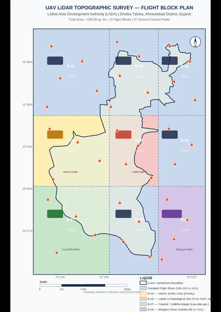
TerraX surveyed 247 sq km of the Lothal heritage region with drone LiDAR, merged every flight block into one seamless terrain model, and gave the master plan team measured ground levels at 0.04 m accuracy.
Cuttack, Odisha
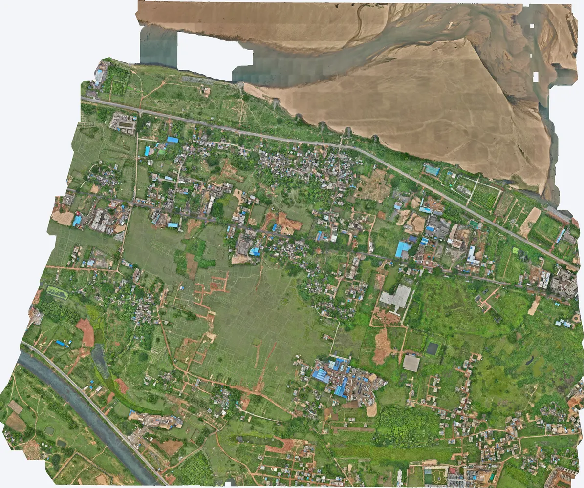
A government department asked TerraX to test whether drone LiDAR could find illegal construction on government land. The pilot covered three villages near Cuttack, and its results were used to plan a much larger programme.
Industrial plant near Sanand
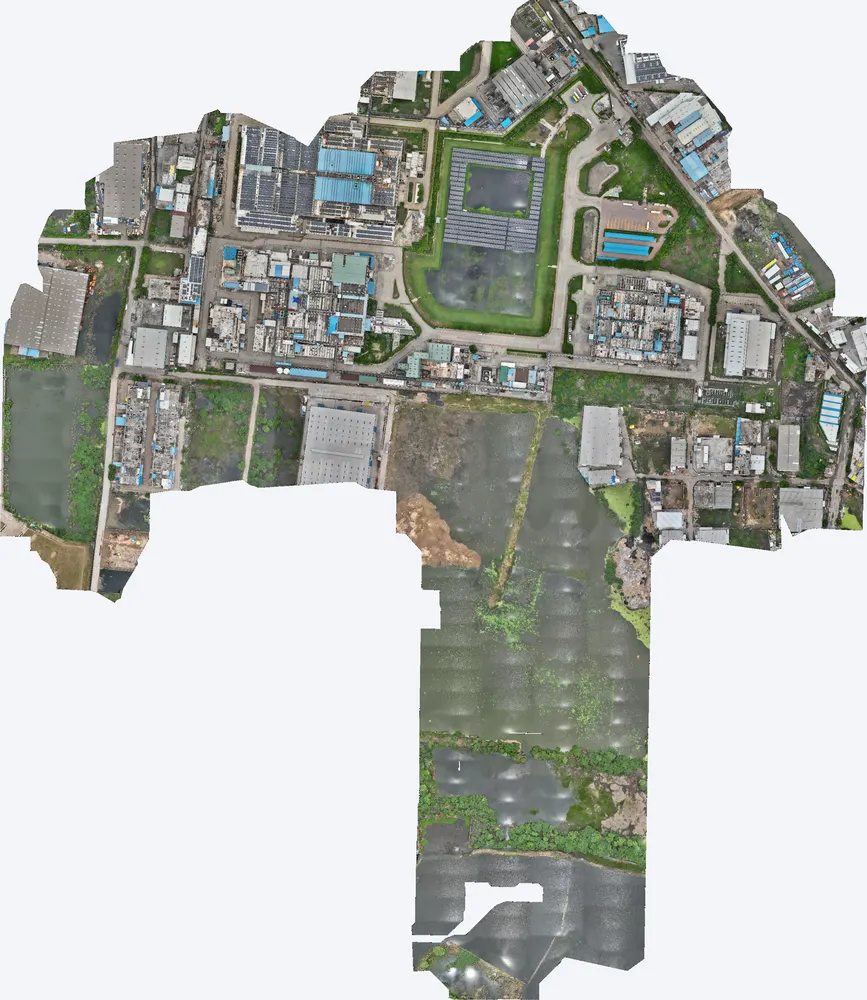
A manufacturing plant near Sanand used a TerraX LiDAR survey to understand how flood water reaches the site, protect its buildings, and work out its flood insurance cover on measured data.
Related guides
Get a quote
Send your KML file, site area, purpose and list of deliverables to Anjali Tripathi. We will answer all 10 questions in our quote. See also: Drone Survey Cost in India and Drone Survey Accuracy.
Contact: Anjali Tripathi · Phone: +91 63546 68494 · Email: contact@terraexplore.in · Website: terraexplore.in
About TerraX: TerraX (TerraExplore) is a drone LiDAR and survey company based in Ahmedabad, working across India. Flying, DGPS ground control and data processing are all done by our in-house team of certified pilots and processing staff. See our services or send an enquiry.