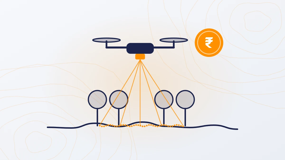
Quick answer: For sites above 200 acres, a drone LiDAR survey costs ₹160–1,000 per acre. A total station or DGPS survey costs ₹2,500–10,000 per acre. The drone needs one day in the field instead of several weeks. A total station is still the better choice for small plots, boundary marking, finished road levels and work inside buildings.
Drone vs traditional survey at a glance
| Total station or DGPS survey | Drone survey | |
|---|---|---|
| Cost per acre (sites over 200 acres) | ₹2,500–10,000 | Camera ₹100–500; LiDAR ₹160–1,000 |
| Area covered per day | 12–25 acres per crew on flat, open land | Up to 1,000 acres |
| Ground points measured | One every 10 m (about 40 per acre) | 200–400 per sq m (0.8–1.6 million per acre) |
| Accuracy at each measured point | A few millimetres | ±5 cm in height |
| Ground between points | Assumed to be a straight line | Measured |
| Under trees and crops | Possible, but slow | LiDAR: yes. Camera: no |
| Crew safety | Crew walks the whole site | Crew stays at the launch point |
| Smallest site it suits | Any size | 200 acres and above |
How much does each method cost?
Rates published by Indian survey firms in 2025–26 put a total station or DGPS topographic survey at ₹2,500–10,000 per acre for larger sites. Small plots cost more per acre, often ₹15,000 or more.
A drone survey costs ₹100–500 per acre with a camera and ₹160–1,000 per acre with LiDAR, for sites of 200 acres or more. The drone method is cheaper because one flight covers what a ground crew takes weeks to walk. See Drone Survey Cost in India for full rates.
How long does each method take?
A ground crew covers about 12–25 acres a day on flat, open land, and 2.5–7 acres a day on hilly ground. A drone covers up to 1,000 acres a day.
| Site area | Ground survey: field days (one crew, flat land) | Drone: field days | Drone: final data delivered |
|---|---|---|---|
| 100 acres | 4–8 | Less than 1 | 5–8 days |
| 500 acres | 20–40 | 1 | 8 days |
| 1,000 acres | 40–80 | 1 | 8 days |
| 5,000 acres | 200–400 | About 5 | 8 days |
Ground survey days are based on a crew output of 5–10 hectares a day, as published in 2026 survey rate guides.
Which is more accurate?
At a single point, a total station is more accurate. It measures each point to a few millimetres.
But a ground survey measures only the points the surveyor walks to, often one every 10 m. The software joins those points with straight lines. If the surveyor misses a drain bottom or the top of a small mound, it does not appear in the data.

A LiDAR survey measures 200–400 points in every square metre, accurate to ±5 cm in height. It records the actual shape of the ground, not a straight line between distant points. On a 247 sq km TerraX LiDAR project, the measured error against DGPS checkpoints was 0.04 m RMSE.
For levels, volumes, drainage and grading design, the dense LiDAR surface usually describes the ground better. For a single exact point, such as a boundary pillar, the total station is better.
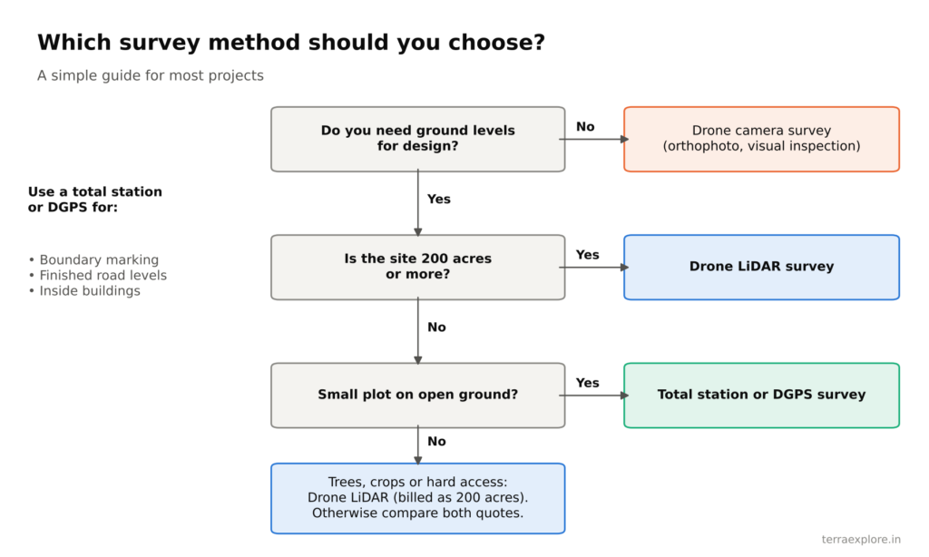
When should you use a drone survey?
- Sites of 200 acres or more
- Roads, canals, pipelines and power lines
- Projects that need ground levels for design: solar plants, townships, drainage, flood studies
- Sites with trees or crops (LiDAR)
- Sites that are unsafe or hard to walk: rivers, mines, saline land, harsh climate
- Repeat surveys to track progress or stockpile volumes
When is a traditional survey better?
- Very small plots, where the drone minimum order (200 acres) is not worth it
- Marking boundary lines on the ground
- Checking finished road levels
- Surveys inside buildings
Many projects use both: a drone survey for the full site and a total station for boundary marking and setting out.
Worked example: a 500-acre site
| Total station or DGPS | LiDAR drone survey | |
|---|---|---|
| Cost (before GST) | ₹12.5–50 lakh | ₹0.8–3.5 lakh |
| Field time | 20–40 crew-days | 1 day |
| Final data delivered | After field work and drafting | 8 days |
| Ground points measured | About 20,000 | 400–800 million |
| Ground under trees | Only where the crew can reach | Measured |
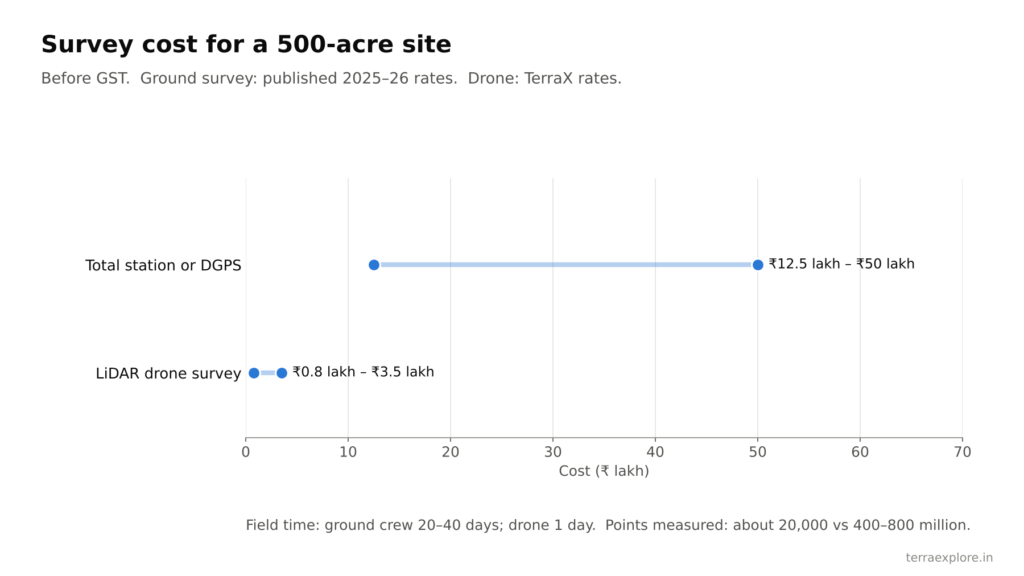
The ground survey figures use published rates of ₹2,500–10,000 per acre and a crew output of 12–25 acres a day. The drone figures are TerraX rates.
Frequently asked questions
Is a drone survey cheaper than a total station survey?
Yes, for sites of 200 acres or more. A drone LiDAR survey costs ₹160–1,000 per acre; a total station or DGPS survey costs ₹2,500–10,000 per acre.
Is a drone survey as accurate as a total station?
A total station is more accurate at each single point. A LiDAR drone survey is accurate to ±5 cm in height but measures 200–400 points per square metre, so it records the ground shape that a total station misses between its points.
Which is faster, drone or total station?
A drone covers up to 1,000 acres a day. A ground crew covers about 12–25 acres a day on flat, open land.
Can a drone survey replace boundary marking?
No. Marking boundary lines on the ground is still done with a total station or DGPS.
Is a drone survey suitable for rivers and mines?
Yes. The crew stays at the launch point while the drone covers rivers, mines, saline land and other areas that are unsafe or hard to walk.
Our service for this
Drone LiDAR Topographic Survey →Contour Mapping and Terrain Modelling →
Related case studies
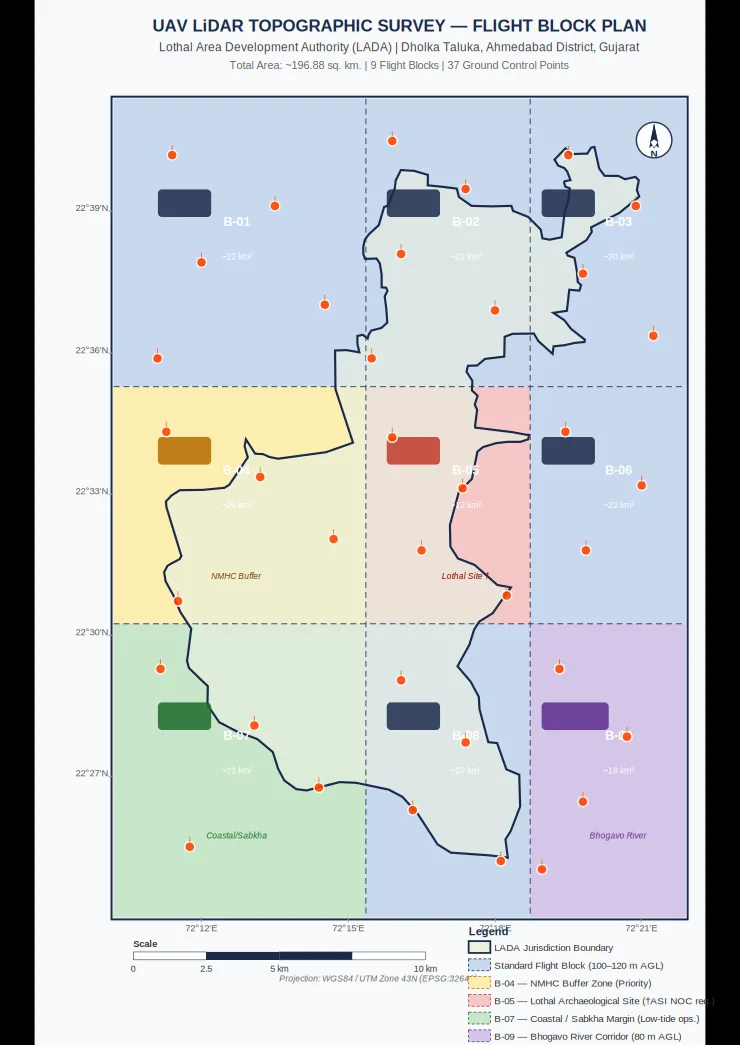
Lothal heritage region
TerraX surveyed 247 sq km of the Lothal heritage region with drone LiDAR, merged every flight block into one seamless terrain model, and gave the master plan team measured ground levels at 0.04 m accuracy.
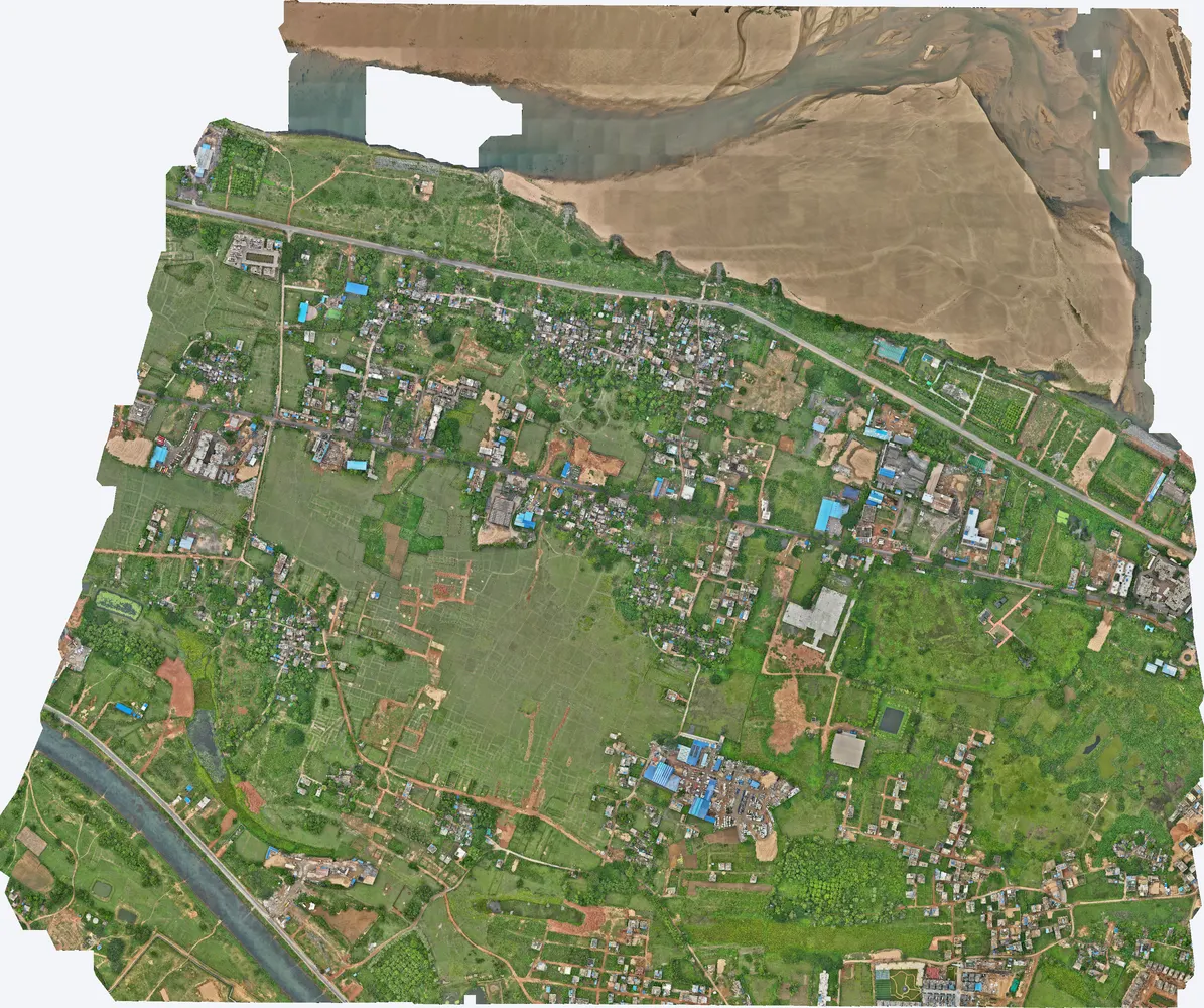
Cuttack, Odisha
A government department asked TerraX to test whether drone LiDAR could find illegal construction on government land. The pilot covered three villages near Cuttack, and its results were used to plan a much larger programme.
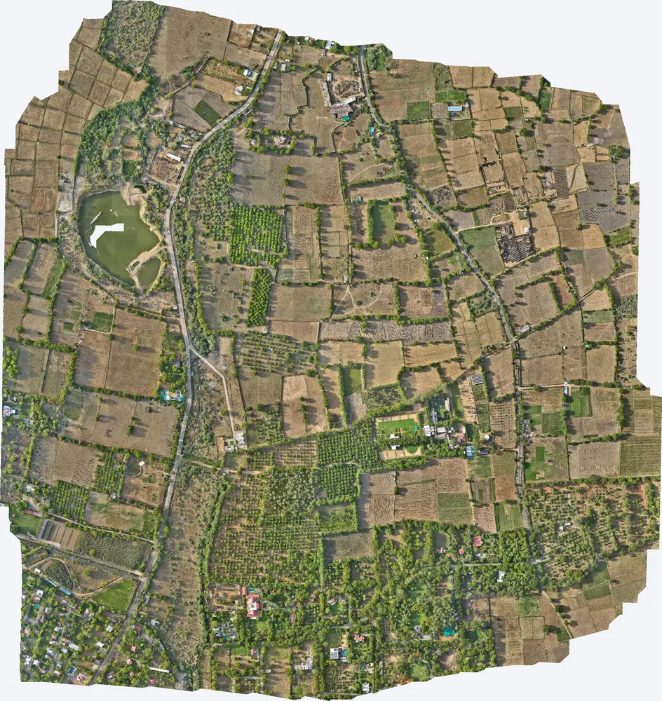
Kharawala, Sanand
TerraX mapped 531 acres around a private residence at Kharawala near Sanand to find the natural drains and the outfall point, so the owner could design drainage that also recharges groundwater.
Related guides
Get a quote
Not sure which method suits your site? Send your KML file, site area and purpose to Anjali Tripathi. See also: LiDAR Survey Cost in India and Topographic Survey Cost in India.
Contact: Anjali Tripathi · Phone: +91 63546 68494 · Email: contact@terraexplore.in · Website: terraexplore.in
About TerraX: TerraX (TerraExplore) is a drone LiDAR and survey company based in Ahmedabad, working across India. Flying, DGPS ground control and data processing are all done by our in-house team of certified pilots and processing staff. See our services or send an enquiry.