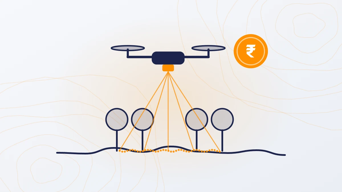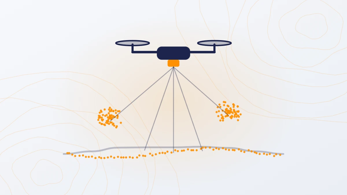
Quick answer: A LiDAR survey measures the shape of the ground using laser pulses. LiDAR stands for Light Detection and Ranging. In a drone LiDAR survey, a laser scanner on the drone records 200–400 points per square metre. The result is an accurate 3D model of the ground and everything on it, with levels to about ±5 cm, even under trees and crops.
What is the full form of LiDAR?
LiDAR stands for Light Detection and Ranging. “Ranging” means measuring distance.
How does a drone LiDAR survey work?
- The laser scanner on the drone sends out laser pulses, many thousands every second.
- Each pulse hits something (ground, tree, roof) and reflects back to the scanner.
- The scanner measures how long the pulse took to return. This gives the distance.
- A GNSS receiver records where the drone is, and a motion sensor (IMU) records which way it is pointing.
- Combining these, each return becomes a point with exact coordinates and height.
- Millions of points together form a point cloud: a 3D picture of the site.

Some pulses pass through gaps between leaves and reach the ground. This is why LiDAR can measure ground levels under vegetation, which a camera cannot.
What do you get from a LiDAR survey?
| Output | What it is | Used for |
|---|---|---|
| Point cloud (LAS file) | Millions of 3D points, sorted into ground, vegetation, buildings and other classes | Base data for all other outputs |
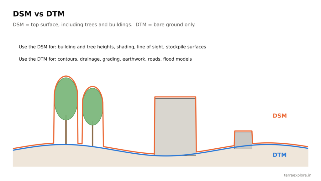
| DTM | Bare ground surface | Design, drainage, flood models |
| DSM | Surface including trees and buildings | Heights, shading, line of sight |
| Contours | Lines of equal height, from 0.25 m interval | Drawings and design |
| Orthophoto | Map-accurate aerial photo | Base map and visual reference |
Where is LiDAR survey used?
- Solar plants: layout, grading and drainage
- Roads, canals, railways, pipelines and power lines
- Townships, TP schemes and industrial parks
- Flood, stormwater and drainage studies
- Mines and stockpiles
- Any site with trees, crops or scrub where ground levels are needed
How is a LiDAR survey carried out?
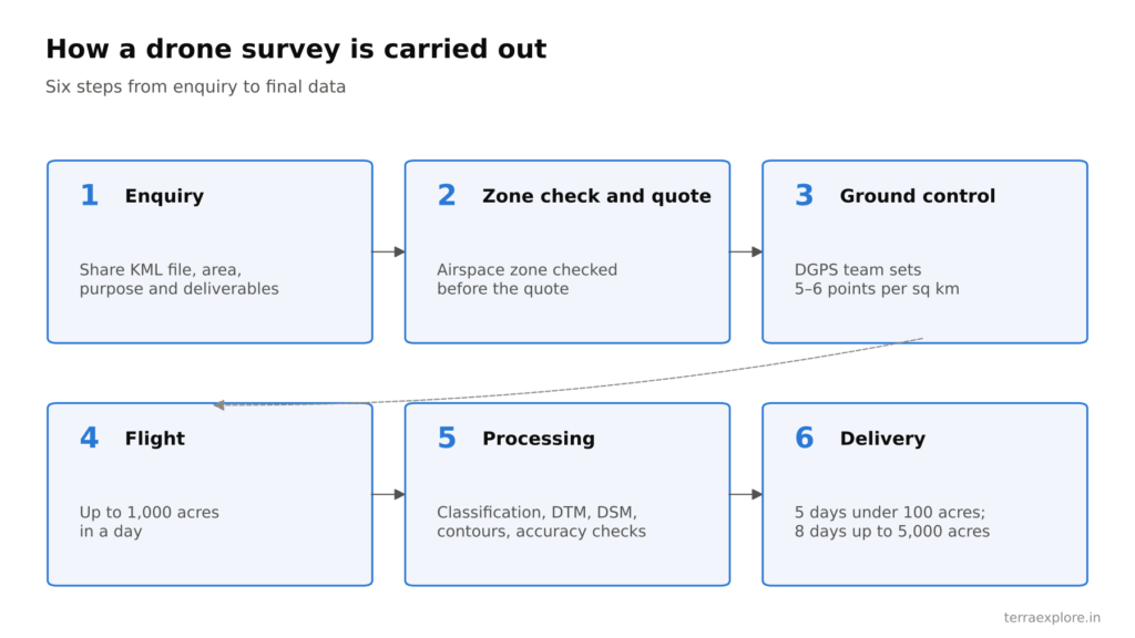
- Enquiry: you share a KML file, area, purpose and deliverables.
- Airspace check and quote: the survey company checks the drone zone and sends a quote.
- Ground control: a DGPS team marks and measures control points on site (TerraX uses 5–6 per square km).
- Flight: the drone covers up to 1,000 acres a day.
- Processing: points are classified, and the DTM, DSM, contours and orthophoto are made and checked.
- Delivery: in 5 days for sites up to 1,000 acres and 8 days for sites up to 5,000 acres.
How much does a LiDAR survey cost?
₹160–1,000 per acre for sites of 200 acres or more, and ₹5,000–10,000 per km for a 150 m corridor, before GST. See LiDAR Survey Cost in India for full rates.
Frequently asked questions
What is the full form of LiDAR?
LiDAR stands for Light Detection and Ranging.
What is a LiDAR survey used for?
It is used wherever accurate ground levels are needed: solar plants, roads, canals, townships, flood and drainage studies, mines, and sites with trees or crops.
Can LiDAR see through trees?
LiDAR pulses pass through gaps between leaves and reach the ground. This gives ground levels under trees, crops and scrub. Very dense canopy reduces the number of ground points.
How accurate is a drone LiDAR survey?
About ±5 cm in height. On a 247 sq km TerraX LiDAR project, the measured RMSE was 0.04 m.
How long does a LiDAR survey take?
The drone covers up to 1,000 acres a day. Final data is delivered in 5 days for sites up to 1,000 acres and 8 days for sites up to 5,000 acres.
Our service for this
Drone LiDAR Topographic Survey →
Related case studies
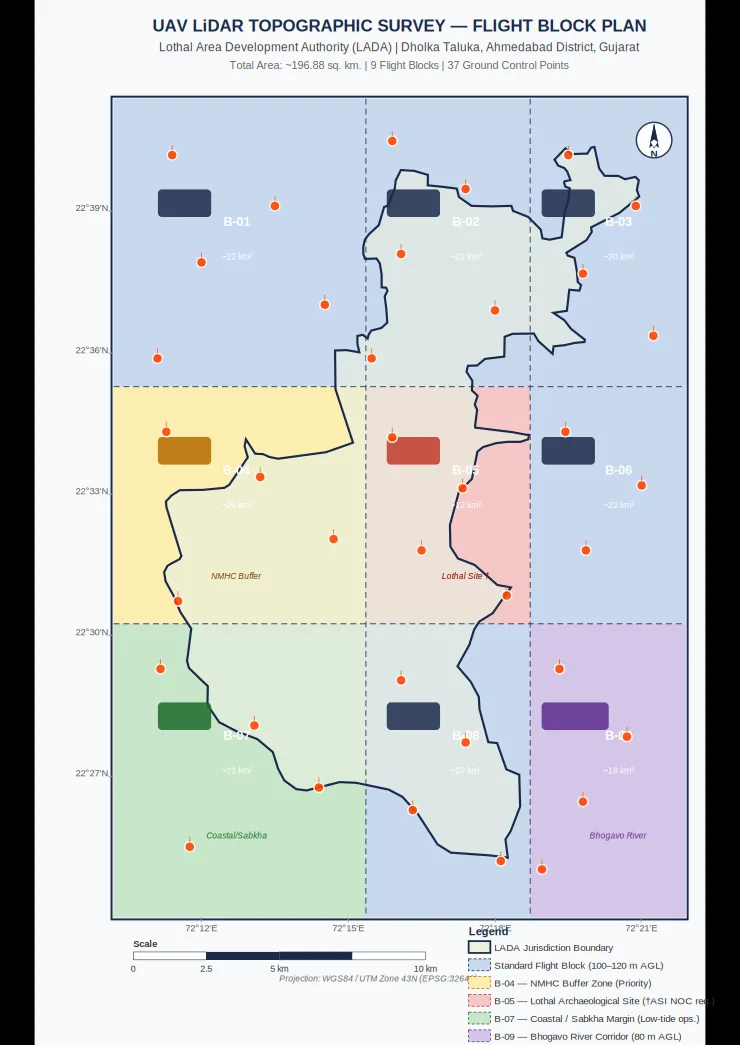
Lothal heritage region
TerraX surveyed 247 sq km of the Lothal heritage region with drone LiDAR, merged every flight block into one seamless terrain model, and gave the master plan team measured ground levels at 0.04 m accuracy.
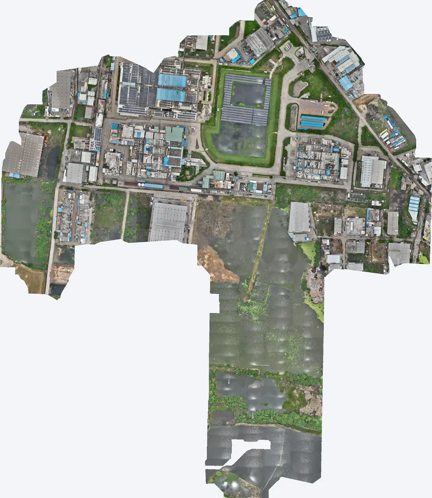
Industrial plant near Sanand
A manufacturing plant near Sanand used a TerraX LiDAR survey to understand how flood water reaches the site, protect its buildings, and work out its flood insurance cover on measured data.
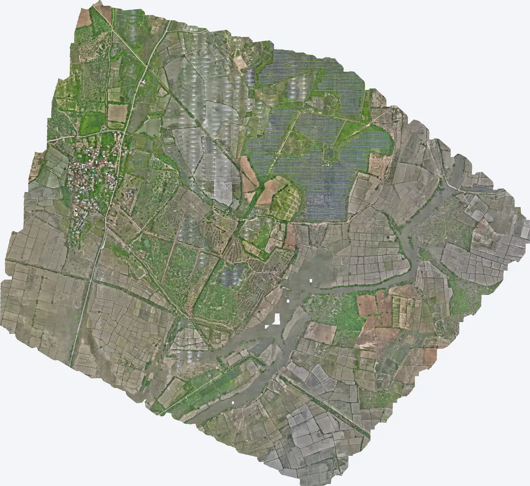
Shukra project, Sanand
TerraX surveyed 1,416 acres for the Shukra horizontal development near Sanand, giving the developer a complete terrain model for layout, roads and drainage planning.
Related guides
Get a quote
Send your KML file, site area, purpose and list of deliverables to Anjali Tripathi. See also: LiDAR vs Photogrammetry and DTM vs DSM vs DEM.
Contact: Anjali Tripathi · Phone: +91 63546 68494 · Email: contact@terraexplore.in · Website: terraexplore.in
About TerraX: TerraX (TerraExplore) is a drone LiDAR and survey company based in Ahmedabad, working across India. Flying, DGPS ground control and data processing are all done by our in-house team of certified pilots and processing staff. See our services or send an enquiry.