
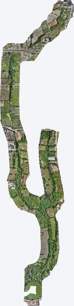
For a government pond interlinking project, TerraX surveyed the drain corridor at Santhal with drone LiDAR, giving the engineers the levels they needed for alignment, bed slope and earthwork design.

| Location | Santhal, near Telav, Sanand taluka, Ahmedabad district, Gujarat |
|---|---|
| Client type | Government |
| Purpose | Engineering design of a drain linking village ponds |
| Area | 0.63 sq km (156 acres) corridor |
| Survey | Drone LiDAR with RGB camera, 5 flights at about 118 m along the corridor |
| Ground control | 6 DGPS control points |
| Outputs | Orthophoto, DSM, DTM, contours, ground point cloud for long and cross sections |
Linking ponds with a drain only works if water flows the right way along the full length. The design needed accurate ground levels along a long, narrow corridor through fields, roads and existing channels.
The corridor was flown in five flights following the planned alignment, with a buffer on each side so that alternative routes could be checked. Control points were placed along the corridor.
Orthophoto, DSM, DTM, contours and a ground point cloud of 130 points per m², from which long sections and cross sections can be cut at any chainage.
The engineering team used the data to fix the alignment, set the bed levels and slopes, and work out earthwork quantities and the locations of crossings.
Images from the TerraX survey report for this project. Click an image to open it full size.
Only a strip around the planned route is flown, so flights and processing are reduced.
Yes. They can be cut from the ground point cloud at any interval along the route.
Send the site location (KMZ or Google Maps pin), approximate area and what you need the survey for. We reply with a method, a price and a timeline.